
Nearmap, a high-resolution aerial imagery provider, and Aurora Solar, a solar sales and design software leader, announced a landmark partnership that allows Aurora users to access Nearmap aerial captures of U.S. locations.
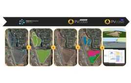
Through this collaboration, Nearmap’s up-to-date, sub 3” GSD imagery is now available within Aurora’s software, helping solar installers design and sell with exact precision.
“We’re thrilled to be partnering with Nearmap to provide aerial imagery to solar installers across the country,” said Chris Hopper, CEO and co-founder of Aurora Solar. “By integrating high-resolution imagery with our industry-leading software, we empower solar installers to quote with confidence—reducing the number of truck rolls required. This is the next big step in remote solar design.”
Previously, Aurora has enabled its users to design over 1 million solar projects, with over 60,000 projects designed in March 2018 alone. Now, in addition to satellite imagery, Aurora customers can utilize high-resolution and current Nearmap imagery for increased accuracy and informed decision-making.
“We’re excited to announce this relationship because it offers a lot of flexibility for both Nearmap and Aurora customers. The partnership offers solutions for businesses of all sizes. Organizations can choose from different licensing models: pay as you go, with unlimited access to imagery, or per bundle through Aurora, which provides a more flexible option based on the needs of the user,” said Patrick Quigley, EVP of Nearmap U.S. In addition, existing Nearmap customers can also authenticate their Nearmap licenses in Aurora.
Alex Chelius of Momentum Solar notes that this integration will “significantly increase our productivity as well as accuracy.”
Through the partnership, users can:
“Every design begins with imagery, and high-quality imagery helps designers create permit-quality drawings and game-changing proposals,” said JT McCook, sales consultant at AuroraSolar. “That’s why this integration is so exciting; it allows solar installers to create highly accurate 3D models remotely.”
To learn more about this important partnership, attend the webinar scheduled for April 12 [th] . You can register here.
News item from Nearmap


Tell Us What You Think!